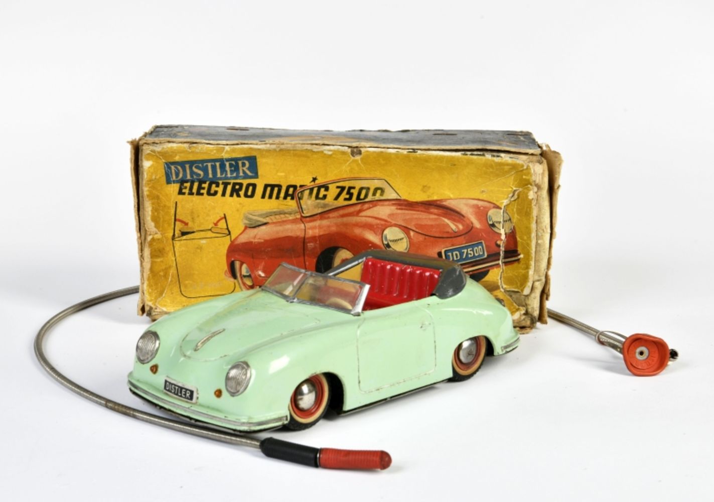
Highlight


Handcol. engr., 47 x 57 cm, depicting an armillary sphere, a celestial globe and a terrestrial globe, Nuremburg, J.B. Homann, ca. 1720, framed und...
Handcol. engr., 47 x 57 cm, depicting an armillary sphere, a celestial globe and a terrestrial globe, Nuremburg, J.B. Homann, ca. 1720, framed und...
Du déjeuner Pullman au diner. Paris-Bruxelles-Amsterdam. Paris, Hachard & Cie, 1927. 106 x 75 cm. Corners and minor dam. to folds, professionally ...
ASHER AND ADAMS Asher & Adams' New Historical and Topographical Atlas of the United States. With Maps Showing the Dominion of Canada, Europe and t...
BLAEU (JAN) Delfi Batavorum vernacule Delft, hand-coloured engraved double-page plan of the city of Delft, Latin text on verso, remnants of archi...
BLAEU (WILLEM AND JAN) Toonneel des Aerdrycz, oft Nieuwe Atlas... Tweede Deels, 2 parts in 1 vol., engraved architectural and allegorical titles ...
Landkarte (Kupferstich) Afrika By H. Moll Geograph Authentizitätszertifikat 1744Laut Wikipedia war Herman Moll ein britischer Kupferstecher, ...
BLAEU (WILLEM AND JAN) Toonneel des Aerdrycks oft Nieuwe Atlas...Vierde Deel, engraved title and 58 engraved maps, marginal damp-staining, small ...
Landkarte Kupferstich Benjamin Baker, Deutschland um 1740 - Heiliges Römisches Reich Deutscher NationAlte Karte von Deutschland von B. Baker, um 1...
Alte Karte Kupferstiche von Afrika von Thomas Jefferys, um 1749Thomas Jefferys (auch: T. Jefferies, Jeffery, Jeffereys, Jeffreys oder Gefferys; *...
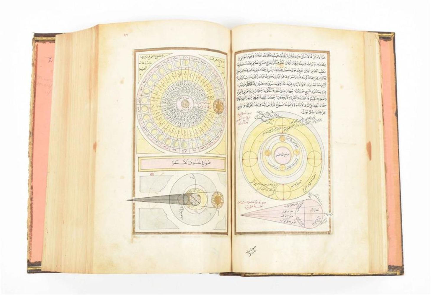
ATTRIBUTED TO DONG GAO (1740-1818) Two Views of...
BRADFORD (THOMAS G.) A Comprehensive Atlas, Geographical, Historical & Commercial, hand-coloured pictorial frontispiece, engraved decorative titl...
Landkarte Kupferstich von John Rapkin Victoria or Port Phillip Australien, um 1850 Landkarte von Victoria or Port Phillip Australien mit dekorativ...
Karte des Mosambikkanals mit Madagaskar und Afrikas Küsten, Kupferstich um 1870 von Rigobert BonneCarte du Canal de Mosambique contenant l'isle de...
Landkarte "Australia with the British Settlements", um 1835Kupferstich einer detaillierten Karte von Australien mit Einlegekarten von Swan River, ...
PRESENTATION COPY. SAINT-SIMON, HENRI DE. Du System Industriel. Paris: Chez Antoine-Augustin Renouard, 1821. 8vo (215 x 139 mm). Contemporary pub...
GRAY (O.W.) Gray's Atlas of the United States, with General Maps of the World, numerous hand-coloured lithographed maps (some double-page, usuall...
LINFORTH (JAMES, EDITOR) Route from Liverpool, to Great Salt Lake Valley Illustrated...by Frederick Piercy, FIRST EDITION, 30 engraved plates and...
MITCHELL (SAMUEL AUGUSTUS) A New Universal Atlas Containing Maps of the Various Empires, Kingdoms, States and Republics of the World. With a Speci...
Agostino Carracci (1557-1602) Saint Francis Receiving the Stigmata (Bartsch 68, Bohlin 140), 1586 Engraving on laid paper, Bohlin's first state (o...
MITCHELL (SAMUEL AUGUSTUS) Mitchell's New General Atlas, Containing Maps of the Various Countries of the World, Plans of Cities, Etc., 59 hand-co...
NORFOLK and SUFFOLK SPEED (JOHN) Norfolk, a Countie Florishing & Populous Described and Devided with the Armes of such Noble Familes as have Borne...
Colmar, Gesamtansicht, Kupferstich, 10 x 33 cm, von Merian, 17. Jh., R
Füssen, 3 Teilansichten, 2 Stahlstiche, 1 handcolorierter Holzstich, verschiedene Größen (größte Abb. 22 x 16,5 cm), 19. Jh., R
Kempten, Gesamtansicht, Kupferstich, handcolor., 34 x 45 cm, von Braun & Hogenberg, 16. Jh., gebräunt, P
SOCIETY FOR THE DIFFUSION OF USEFUL KNOWLEDGE The Complete Atlas of Modern, Classical and Celestial Maps, together with Plans of the Principal Cit...
Landkarte "Apmliss et Prudentiss...Leutkirch", Kupferstich, 26,5 x 34 cm, von Merian, um 1650, gebräunt, fleckig, R
SPEED (JOHN) AND WILLEM BLAEU Pictorial title-pages to Speed's 'Theatre of the Empire of Great Britain', 1650, and Blaeu's 'Le Théâtre du Monde......
Landkarte "Carte Generale de la Pologne (Polen)", Kupferstich, handcolor., 30 x 44,5 cm, von M. Rizzi Zannoni, 18. Jh., R
SPEED (JOHN) Yorkshire; The North and East Ridings of Yorkshire, inset plans of Hull and Richmond; The West Ridinge of Yorkeshyre with Most Famou...
Landkarte "Ducatus Andegavensis (Anjou)", Kupferstich, handcolor., 38 x 49 cm, von Bleau, um 1630, Ränder gebräunt
Landkarte "Le Tyrol", Kupferstich, handcolor., 48 x 54 cm, von P. Santini, 1778, R
Landkarte "Les deux poles arctique... et antarctique...", Kupferstich, handcolor., 38,5 x 53,5 cm, von Pruthenus, nach Sanson, um 1700, Knick- und...
Landkarte "Poloniae Regnum (Polen)", Kupferstich, handcolor., 19,5 x 25,5 cm, von M. Seutter, 18. Jh., R
Landkarten, 2 Stück "Vermandois und Calais", 2 Kupferstiche zu einem Blatt zusammengefügt, Gesamt 44,5 x 55 cm, bei J.B. Vrients, Antwerpen, um 16...
FRENCH REVOLUTION - LOUIS XVI Document signed and subscribed by the King ('Bon Louis'), and his secretary, ordering Joseph Duruey, Administrator o...
Landkarten, 6 Stück, verschiedene Techniken und Größen (größte Karte 120 x 78 cm), u.a. Balkan, Ravenstein, Insel Rügen, 18.-20. Jh., teils leicht...
Moskau, Panoramaansicht vom Kreml, Radierung, 26 x 55 cm, undeutl. handsign., dat. 1997, num. 9/20, R
Ortsansichten, 7 Stück - Klöster, 7 Kupferstiche, je ca. 7 x 13 cm, u.a. Kloster Kastell, Rottenbuch, Spenshart, Wessobrunn, 18. Jh., gebräunt, je...
Pompeii, Teilansicht, Kupferstich, handcolor., 28 x 40 cm, von Berthault, 18. Jh., R
Raab in Oberungarn, Gesamtansicht, Kupferstich, 14,5 x 23 cm, bei Jos. Eder, Wien, 18. Jh., R
Salernes, Teilansicht, Kupferstich, handcolor., 28 x 40 cm, von Miamel, 18. Jh., R
Framed Fraktur Portrait of George Washington, America, mid-19th century. Equestrian portrait in blue, red, and black ink on trimmed sheet of wove...
Yoshida Hiroshi (1876-1950) Chikugo River, 1927 Woodcut in colors on Japan paper, signed in pencil, titled and sealed Hiroshi and with the jizuri ...
St. Gallen, Ansicht aus der Vogelschau, Kupferstich, 15 x 22 cm, von Bodenehr, 18. Jh., R
Trontheim (Dronheem), Ansicht aus der Vogelschau, Kupferstich, 27,5 x 33,5 cm, von Dahlberg, um 1700, leicht gebräunt und fleckig
Speed (John) Wales, double-page hand coloured engraved map, inset views, Royal Arms, ships and sea-monsters, a further 12 views to the borders, J...
ANSON, GEORGE, BARON. 1697-1762. A Voyage Round the World, in the Years MDCCXL, I, II, III, IV. London: For the Author by John and Paul Knapton, 1...
(Anversa, 1682 - 1716)Veduta costiera con vascelli e figure Olio su tela applicata su tavola, cm 45,5X66Provenienza:Londra, Sotheby's, 13 luglio 1...
CELLARIUS, ANDREAS. 1596-1665. Harmonia macrocosmica seu atlas universalis et novus, totius universi creati cosmographiam generalem, et novam exhi...
CELLARIUS, ANDREAS. 1596-1665. Hypothesis Ptolemaica Sive Communis Planetarum. Amsterdam: J. Jansson, 1661. Engraved map with early hand coloring...
A WWII Second World War British ' escape ' silk map of Eastern Europe & Greece sheets 43 H and G. Scale 1;100,000. Folds to pocket handkerchief si...
CELLARIUS, ANDREAS. 1596-1665. Circa Orbem Terrarum Spiralis Revolutio. Amsterdam: J. Jansson, 1661. Engraved map with hand-coloring, 435 x 505 m...
CELLARIUS, ANDREAS. 1596-1665. Planisphaerivm Ptolemaicvm Sive Machina Orbivm Mvndi. Amsterdam: Schenk and Valk, c.1708. Engraved map with early ...
CELLARIUS, ANDREAS. 1596-1665. Scenographia systematis mundani Ptolemaici. Amsterdam: Schenk and Valk, c.1708. Engraved map with early hand color...
CELLARIUS, ANDREAS. 1596-1665. Scenographia Compagis Mvndanae Brahea. Amsterdam: Schenk and Valk, c.1708. Engraved map with early hand-coloring, ...
SU LIUPENG (1791-1862) Figures Two ink and col...
CELLARIUS, ANDREAS. 1596-1665. Corporum Coelestium Magnitudines. Amsterdam: Schenk and Valk, c.1708. Engraved map with early hand coloring, 420 x...
PEARY'S COPY OF AN EARLY NORTH AMERICAN MAP. PEARY, ROBERT E. 1856-1920.] DOBBS, ARTHUR. 1689-1765. A Map of Part of North America From the Latitu...
Metal Sign Motorcycle Repair & Sales. Overall good condition the dirt and rust on the sign are printed effects instead of actual wear. Dimensions ...
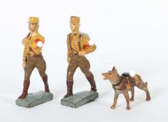
2 SA Soldaten mit HundLineol und Elastolin, 7,5-cm-Serie, SA, Lineol Fahnenträger ohne Fahne; Lineol Maschierer; Elastolin Sanitäts-Hund; min. Al...


![BLAEU (JAN) Delfi Batavorum vernacule Delft, [Amsterdam, 1649 or later]; BLAEU (WILLEM) Novus X...](https://portal-images.azureedge.net/auctions-2024/bonham10855/images/73460c6e-1380-48e8-bc29-b179011a54d5.jpg?h=175)


![SPEED (JOHN) Yorkshire; The North and East Ridins of Yorkshire; West Ridinges, [c.1730], hand-co...](https://portal-images.azureedge.net/auctions-2024/bonham10855/images/38d5b31b-fc81-4c30-82bb-b179011a54ac.jpg?h=175)


![PEARY'S COPY OF AN EARLY NORTH AMERICAN MAP. PEARY, ROBERT E. 1856-1920.] DOBBS, ARTHUR. 1689-17...](https://portal-images.azureedge.net/auctions-2024/bonham11059/images/f375831b-9ffa-4142-831b-b18f0138227a.jpg?h=175)