Filtered by:
- Category
- List
- Grid
-
21 item(s)/page
A subscription to the Price Guide is required to view results for auctions ten days or older. Click here for more information
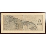

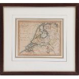
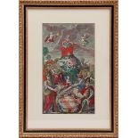
Topographical colored engraving of the Northern Netherlands, by Pierre van der Aa (1659-1733), ca. 1700, 44x112 cm, in total frame 62.5x129 cm
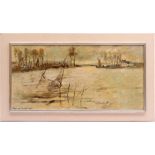
Ben van Londen (1907-1987)
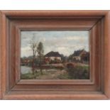
Ben van Londen (1907-1987)River view at Lexkesveer with traps, board dated 1980, 45x90 cm
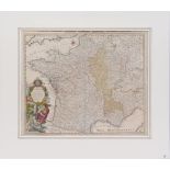
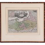
Antique topographic map Regni Galliae Franciae et Navarrae, Homannianos Heredes 1741, 50x60 cm
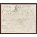
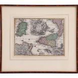
Topographical colored Carte Des Pays Bas Catholiques, par Guillaumede l'Isle, 18th century52x63 cm
Johannes Embrosius van de Wetering de Rooij (1877-1972)Farm with a view of the Linge near Aquoy, panel 20.5x28.5 cm
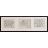
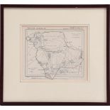
3 antique topographical maps in 1 frame, outer size 35x103 cm
Topographic map, Sicilia Regnem
Topographic map, Sicilia Regnem, outer size 35x39 cm
Topographic map of Borussia Regnem, outer size 35x39 cm
Topographic map Province of Gelderland municipality of Ede / Otterlo, outer size 32x35 cm
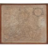
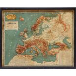
Topographic map, The seven United Provinces, outer size 37x41 cm
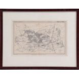
Topographic map Province of Gelderland, municipality of Apeldoorn, outer size 36x46 cm
Topographic map New map of the free landscape Drenthe MDCCXCV, outer size 34x40 cm
Title page from atlas, M. Seutter / A. Vindel - Atlas Novus Sive Tabula Geographica (...) - ca. 1740, 49x28 cm in a classic frame, outer dimension...
Dono della Gazzetta Piemontese del 1890, Europe in Rilievo, relief map of Europe, 44x55 cm
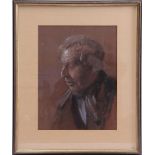
Jos Lussenburg (1889-1975)
Jos Lussenburg (1889-1975)Portrait of Aalt Ponstein, born in 1898 in Oldebroek and son of Jan Willem Ponstein and Geertje Hoekert,crayon 41x31 cm
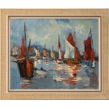
Jan Kelderman (1914-1990)
Jan Kelderman (1914-1990)Harbor view with many ships, Southern Europe, canvas 40x50 cm
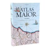
Joan Blaeu Atlas Maior, "the largest atlas ever published", 45x31 cm
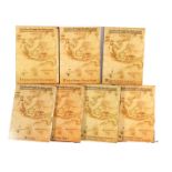
Jos Gommans & Rob van Diessen Large Atlas of the Dutch East India Company, 7-part book series from 2010, all numbered 0624/1600, 57x47 cm, approxi...
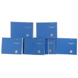
Günter Schilder Monumenta Cartographica Neerlandica, 9-part book series with many maps from 1986-2009, 41x52 cm
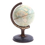
Reliable Series metal globe with meridian ring on metal base, England ca. 1930, 20 cm high
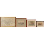
4 various wall decorations
4 various wall decorations of Arnhem, including a map of Arnhem early 1900, outer size 44x64 cm and a colored topographical engraving ground drawi...
-
21 item(s)/page