Filtered by:
- Category
- List
- Grid
-
20 item(s)/page
A subscription to the Price Guide is required to view results for auctions ten days or older. Click here for more information
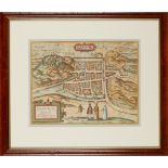
![[after] Ortelius, Abraham Angliae, Scotiae, et Hiberniae sive Britannicum Insularum Descriptio](https://portal-images.azureedge.net/auctions-2021/srly10316/images/a83bba5b-d163-427c-8226-acc200c10d4f.jpg?w=155&h=155)

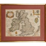
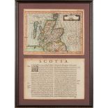
[after] Ortelius, Abraham Angliae, Scotiae, et Hiberniae sive Britannicum Insularum Descriptio
[after] Ortelius, Abraham Angliae, Scotiae, et Hiberniae sive Britannicum Insularum Descriptio [probably Amsterdam: Baptista van Doetechum, c.1605...
2 bound folios of European maps comprising Folio 1 Carta del Territorio d'Orvieto e territorio di Perugia. Rome, 1803, engraved by Bernard Olivier...
A collection of framed maps Four maps, comprising Marian, Matthaus Magnae Britanniae et Hiberniae Tabula, [Frankfurt, 1636], 28 x 36cm, hand colou...
Blaeu, Jan A collection of maps Provincae Lauden seu Lothien et Linlitouo, 38 x 54cm, hand coloured, framed and glazed, some browning; Annandiae, ...
Blaeu, Jan 8 framed and glazed Scottish maps, 17th century Caricta Borealis, 51 x 62cm, a little foxing; Lidalia vel Lidisdalia Regio, 35 x 58cm, ...
![Blaeu, Joan Guilliemius Theatrum Orbis Terrarum [Toonneel des Aerdrycx oft Nieuwe Atlas]: Volume V](https://portal-images.azureedge.net/auctions-2021/srly10316/images/2eece3a8-0659-45e7-9343-acc200c13c44.jpg?w=155&h=155)
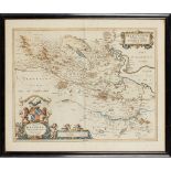
Blaeu, Joan Guilliemius Theatrum Orbis Terrarum [Toonneel des Aerdrycx oft Nieuwe Atlas]: Volume V
Blaeu, Joan Guilliemius Theatrum Orbis Terrarum [Toonneel des Aerdrycx oft Nieuwe Atlas]: Volume V Amsterdam: J. Blaeu, 1654. Folio, engraved titl...
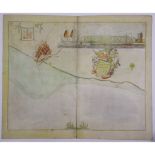
Braun, Georg & Franz Hogenberg Edenburgum, Scotiae Metropolis Cologne, C.16th, hand coloured map, 34 x 46cm, framed and glazed ...[more]
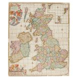
De Wit, Frederick Novissima prae caeteris aliis accuratissima Regnorum Angliae, Scotiae, Hiberniae
De Wit, Frederick Novissima prae caeteris aliis accuratissima Regnorum Angliae, Scotiae, Hiberniae Amsterdam, late 17th century, 59 x 50cm, hand c...
Hondius, Henricus, and others A Collection of French Maps Galliae Supra omnes... [Amsterdam, after 1631], 38 x 51cm, hand coloured, framed and gla...
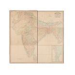
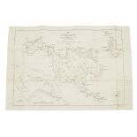
India - Walker, John, mapmaker to the East India Company Map of India, shewing the British London: Wm. H. Allen, 1853. Large, folded linen-backed...
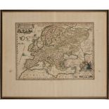
Janssonius, after Abraham Ortelius Europam sive Celticam Veterem Amsterdam, c.1650, 52 x 62cm, hand-coloured, framed and glazed, some slight disco...
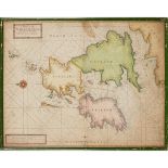
Maps of Scotland 7 maps, comprising Janssonius, Johannes Scotia Regnum. [N.p., n.d. but c.1670], 20 x 27cm, hand coloured, double glazed along wit...
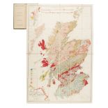
Nicol, James Geological Map of Scotland Edinburgh & London: W. Blackwood, [1857300], hand-coloured engraved map, divided into 24 sections and back...
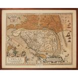
Ortelius, Abraham Chinae, olim Sinarum regionis, nuova descriptio [Antwerp: Luiz Jorge De Barbuda (Ludovico Georgio), 1584?] presumed first state ...
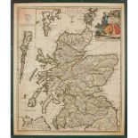
Sanson d'Abbeville, Nicolas Le Royaume d'Ecosse Paris: H. Jaillot, [c.1695], hand-coloured in outline, 63 x 91cm, framed and glazed, very slightly...
Scotland and Cornwall 6 maps, including A New Map of the County of Cornwall. London: C. Smith, 1804, 50 x 55cm, hand coloured, laid onto board wit...
Seller, Jeremiah and Charles Price A Chart of the Narrow Seas London: [n.d.], a later state c.1700, 44.5 x 56.5cm, hand-coloured, laid-down, a lit...
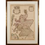
Senex, John, after Gordon of Straloch A New Map of Scotland [N.p., 1721] 49.5 x 58.5cm, hand-coloured, framed and glazed
St Kilda - Mathieson, John and A.M. Cockburn, surveyors Map of St Kilda or Hirta and Adjacent Islands & Stacs. Ordnance Survey, 1928, folding map,...
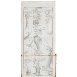
Taylor, George and Andrew Skinner Taylor & Skinner's Survey and Maps of the Road of North Britain
Taylor, George and Andrew Skinner Taylor & Skinner's Survey and Maps of the Road of North Britain London: for the Authors, 1776. Folding title, fo...
-
20 item(s)/page