Refine your search
Filtered by:
- Category
- List
- Grid
-
5 item(s)/page
A subscription to the Price Guide is required to view results for auctions ten days or older. Click here for more information
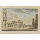

ST CHRISTOPHER'S CHURCH, THE BANK OF ENGLAND AND ST BARTHOLOMEW'S CHURCHa coloured engraving 19 x 25cm, andHANOVER SQUAREpublished according to Ac...
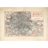
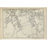
GROWTH OF LONDON MAPS 1901-1902,
GROWTH OF LONDON MAPS 1901-1902,a complete set of London County Council's 6inch Maps - 'Shewing the Growth of London - Edition 1901-1902', 35 shee...
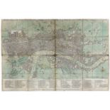
BOWLE'S REDUCED NEW POCKET PLAN OF THE CITIES OF LONDON AND WESTMINSTER 1785,a copper engraved and hand-coloured map of the Cities of London and W...
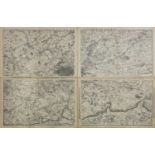
CASSELL'S MAP OF THE ENVIRONS OR TWENTY MILES ROUND LONDON, c.1864, map including four sheets covering Chelmsford to Guildford, published by Casse...
SUBURBS OF PECKHAM & C.,
SUBURBS OF PECKHAM & C., c.1864, map covering Camberwell, Dulwich and Peckham, published by Cassell,34.6 x 50.7cmCondition report: overall good co...
-
5 item(s)/page