Refine your search
Category
- Books & Periodicals (1075)
- Prints (840)
- Collectables (151)
- Photographs (114)
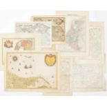
- Maps (94)
- Drawings & Pastels (42)
- Models, Toys, Dolls & Games (32)
- Watercolours (31)
- Oil, Acrylic paintings & Mixed Media (28)
- Sporting Memorabilia & Equipment (21)
- Arms, Armour & Militaria (18)
- Musical Instruments & Memorabilia (18)
- Silver & Silver-plated items (15)
- Sculpture (11)
- Japanese Works of Art (10)
- Chinese Works of Art (8)
- Classic Cars, Motorcycles & Automobilia (6)
- Watches & Watch accessories (4)
- Stamps (3)
- Textiles (3)
- Ceramics (2)
- Clocks (2)
- Indian Works of Art (2)
- Bank notes (1)
- Cameras & Camera Equipment (1)
- Carpets & Rugs (1)
- Coins (1)
- Furniture (1)
- Glassware (1)
- Jewellery (1)
- Religious Items & Folk Art (1)
- Vintage Fashion (1)
- List
- Grid
-
2539 item(s)/page
A subscription to the Price Guide is required to view results for auctions ten days or older. Click here for more information
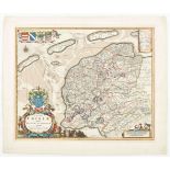

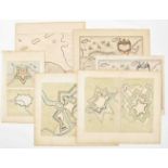
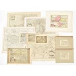
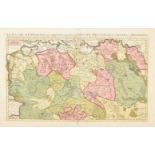
Autoribus Bernhardo Schotano a Sterringa. Suffrido Atonis Haacma et Sixto gravio. Amst., Jacobus van Meurs, ca. 1665. 42 x 52 cm. Contemp. col. co...
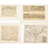
Three maps: Dominii Frisiae Tabula,
inter Flevum et Lavicam, Auctore B. Schotano a Sterringa. Amst., Nicolai Visscher, ca. 1700. 48 x 57 cm. Copper engr. map taken from a Visscher At...
Auctoribus Adriano Metio et Gerardo Freitag. Amst., H. Hondius and/or Johannes Janssonius, 1630-1650. Engr. by E.S. Hamers-veldt et E. Rogers, sig...
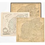
18th to 20th cent. (1-4) Maps by B. Schotanus a Sterringa. Leeuwarden, F. Halma, 1718. Incl. 2 copper engr. w. Lemsterland, Baarderadeel, Aengwerd...

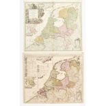
Paskaarte van de kuste
van Holland en Vriesland. Groeninger, Emder en Reydingerland, Holstyn, Ditmarsche en't Eydersted. Amst., Joannes van Kuelen (=van Keulen), ca. 168...
Schakels met het verleden. De geschiedenis van de kartografie van Suriname 1500 - 1971/ Eslabones con el pasado. La historia de la cartografia de ...
et les quatre Parties avec les différents Etats d'Europe. Paris, Lattré, 1782. 12mo. Contemp. gilt red mor., a.e.g., handcol. engr. frontisp. and ...
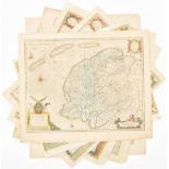
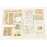
Nine maps
17th to 19th cent. (1) Regional map of Amsterdam [Amstelredam] and surroundings. 17th cent. copy of a part of Joost Jansz Beeldsnijders map: Caert...
van het Koninkrijk Belgie. Den Haag, A.P. van Langenhuysen, 1843. 235,(2) p. Obl., 25 x 33 cm. Hleather, title w. vignette, complete w. 10 lithogr...
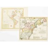
deel der Weereld (...) Scheepstogten der Nederlanderen naar Westindie. Amst., Tirion, 1754. 34 x 36 cm. Handcol., fold. as issued.(2) Nieuwe Kaart...
van het Oostelykse deel der Weereld (...) Scheepstogten der Nederlanderen naar Oostindie. Amst., Tirion, 1753. 32 x 36.5 cm. Handcol., fold. as is...
Accuratissima Tabula. Amst., 1631. 48 x 60 cm. Col., fold. as publ., ill. borders, upper and lower sides w. towns and views in ovals, left and rig...
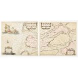
Tot aen 't eylandt Roosenburgh alsmede 't inkoomen van't Goereesche gat (...).(2) Pascaert Van't eylandt Roosenburg door de Oude en Nieuwe Maes to...
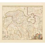
Provinciarum Typus. Arnhem, J. Janssonius, 1614. 25 x 32 cm. Verso German text. Map from Emanuel van Meteren's Eigentliche und volkomene Historisc...
communi nomine vulgo Hollandia nuncupata Continens Statum potentissimae Batavorum Reipublicae seu Provincias VII Foederatas. Nuernberg, J.B. Homan...
Comitatus Drentiae D.D. Statoribus Eorumq (...) Reflore scentis Provinciae et Westerwoldiae Domini (...) [Auct.] Cornelis Pynacker. Amst., Henricu...
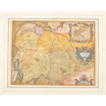
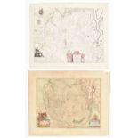
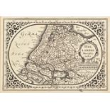
Two maps: Frisia Occidentalis
Author Sibrandus Leovardiensis. Antwerp, Abraham Ortelius, 1579. 36.5 x 50.5 cm. Col., large cartouche w. inset Antiquae Frisiae (19 x 15 cm), ver...
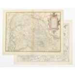
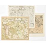
Six maps: Groninga Dominium
Auctore Bartholdo Wicheringe. Amst., Willem Blaeu, ca. 1650. German ed. 38 x 49 cm. 2 large cartouches w. coat of arms, title and scales.(2) The s...
Tabulae Dominii Groeningae
Quae et complectitur maximam partem Drentiae emendata a F. de Wit. Amst., ca. 1690. 47 x 55 cm. Outline and cartouche col., w. coat of arms, scale...
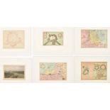
Amst., Willem and Joan Blaeu, ca. 1650. 39 x 50.5 cm. Col., gilt floral cartouche w. putti and title from a Latin ed. Foxed and waterst., mostly n...
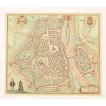
One map of Braun and Hogenberg
Trajectum ad Mosam Cologne. Ca. 1600. 35.5 x 41.5 cm. Verso Latin text, faded col., some modern col., printer's mistake next to middle fold. Sl. b...
Novo Descriptio. Amst., Pieter van de Keere, 1616. 38 x 49 cm. Col., 2 cartouches w. title, coat of arms, view of Limborgh town in Belgium, scales...
Braun and Hogenberg
Dordracum vulgo Dortt me Mosa & Walis, Linga, Meruaque cingunt (...). Cologne, ca. 1600. 31.5 x 50 cm. View w. 2 cartouches, title, coat of arms, ...
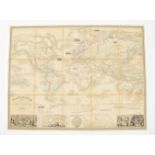
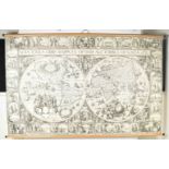
Planisphère illustré
présentant la description géographique des parties connues de la Terre (...) les colonies des diverses nations (...) dressé par Vuillemin. Gravé p...
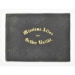
Missions-Atlas der Brüder-Unität
Herausgegeben vom Missions-Departement der Unitäts-Aeltesten-Conferenz zum besten der Brüder-Mission. Levin Theodor Reichel. Herrnhut, Gnadau and ...
with Part of Agra and Delhi exhibiting the Course of the Ganges from Hurdwar to the Sea. Surveyed by James Rennell. London, for William Faden, 178...
de la ville de Bruxelles et ses environs. G. Jacowick, 1812. 30 segments w. town plan, coat of arms and street list.(2) W.H. Loth. Kaart van Guian...
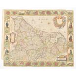
38.5 x 53 cm. Map of Gelderland, the area around Nijmegen between Schenkenschans and Loevenstein, after J. Blaeu in a later [ca. 1680] ed. Col. w....
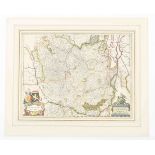
Four maps: Ducatus Geldriae
Batavae et Hispanicae in Tetrarchias Noviomagi, Arnhemii, Ruremondae & Zutphaniae Comitatus. Amst., Carolus Allard, 1705. 60 x 50 cm. Large allego...
Sive Velavia, after F. de Wit. Amst., Covens and Mortier, ca. 1750. 47 x 57 cm. 2 cartouches w. title, putti, scales and coat of arms. Faded col.,...
21 maps: Ducatus Gelriae
pars quarta quae est Arnhemiensis sive Velavia. Amst., Johannes Janssonius, ca. 1650. 39 x 52 cm. 3 cartouches w. title, coat of arms, legend and ...
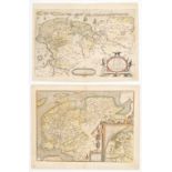
Aut. Christiaan Schrot. Antwerp, Abr. Ortelius, ca. 1580. 37 x 50.5 cm. Fully col., large cartouche w. title, scales on top, verso Latin text. Add...
Geldria et Transysulana
(Amsterdam), Gerard Mercator, ca. 1620. 35.5 x 46.5 cm. Col., verso French text.Added: Another similar copy, ca. 1630. Col., verso Latin text. (to...
et Zutfania Comitatus. Amst., G. Blaeu, ca. 1650. 39 x 50.5 cm. Doubled, verso blank.(2) Ducatus Geldriae Nov. Descr. B.F. van Berkenrode. Amst., ...
18 maps of Zutphen and surroundings
(1) Comitatus Zutphania. Amst., C.J. Visscher, 1634. Folio. Inset town plan, col., verso Dutch text.(2) Nic. v. Geelckerken. Comitatus Zutphania. ...

Vulgo Over-IJssel. Amst., C.J. Visscher, 1652. Folio. Large floral cartouche w. title, coat of arms, legend, etc. Sm. margins, professionally rest...
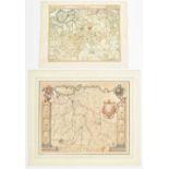
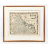
Brabantiae Descriptio
Antwerp, Abraham Ortelius, 1591. 37 x 48 cm. Faded col., verso Spanish text, cartouches w. title, scales and inset Mechelen Dominium.From the atla...

Brabantia Ducatus
Amst., Petrus Kaerius, 1617 (or 1621). 35.5 x 51 cm. Fully col., verso Latin text, leaf 25/26, cartouches w. insets of Mechelen, Antwerp, Court of...
Inferioris (...) Descriptio. Antwerp, Abraham Ortelius, ca. 1600. 37 x 50.5 cm. Verso Brabantia, Latin text, col. faded. Repaired on center fold w...
Brabantia Ducatus
Guiljelmum Blaeuw. Amst., [1638]. 39 x 51 cm. Col., 2 cartouches w. title, coat of arms and scales, in passe-partout, folio leaf from a French ed....
cujus caput Sylvaducis. Amst., Publ. Guiljelmum Blaeu, ca. 1635. 43 x 54 cm. Faded col., signed in the plate, in passe-partout, regional map, seve...
Two maps: Brabantia Ducatus
Amst., Guiljelmum Blaeuw. ca. 1640. 39 x 50 cm. Col., 2 cartouches w. title, coat of arms and scales, verso Latin text Sl. browned, a brown spot n...
(...) March. S. Rom. Imp. Baroniam Bredanam. Amst., Henricus Hondius, ca. 1635. Double folio leaf from an English ed.(2) Brabatiae Batavae pars oc...
de Louvain, Bruxelles, Anvers, et Bosleduc diviséz en leurs principales Iurisdictions (...) Partie septentrionale. Paris, H. Jaillot, 1696. 50 x 8...
of Low Germanie, mended a new in manie places. [London, G. Humble], ca. 1626. 41.5 x 54 cm. Framed w. passe-partout under glass, 66 x 78 cm. Cropp...
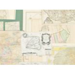
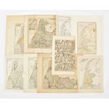
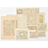
Collection of 27 "stafkaarten",
various sizes, all mounted in sections on fold. linen, various eds.W. some tears on folds/ in loose parts. Incl. a.o.: 9 maps of Amsterdam, Geertr...
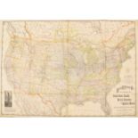
Canada, British Columbia and Northern Mexico showing all the Railroads, Counties and Principal Towns up to date. Constructed from the latest Gover...
tabula in lucem edita a Frederico de Wit. Amsterdami, ca. 1680. 46 x 56.5 cm. Engr. by Abraham Deur, col., title on top, allegorical cartouches w....
Ptolemy. Mercator. Halma ed. 1695
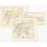
Collection of 20 maps, all damaged on top center fold, from an incomplete historical atlas by Francois Halma. Utrecht, 1695 W. Mercator maps. Dam....
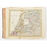
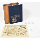
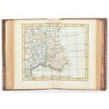
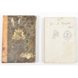
van de Zeven Vereenigde Nederlandsche Provintien (...). Amst., 1773. 8vo. 156,(4) p. Hleather w. boards, spine w. title in red and gilt, endpapers...
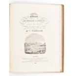
Le voyageur en Hollande
Ouvrage indispensable pour chacun qui voyage dans ce pays. Seconde édition. Orné d'un atlas de 19 cartes. Amst. etc., L.A.C. Hesse, n.d. (1807). (...
met alle de Steden, Dorpen, Ambachten, Litmaten, Polders, etc. N.pl., 1712. Obl. large folio. Contemp. mottled calf w. raised bands, gilt and ribb...
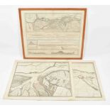
(1) De rivier de Merwede van (omtrent) de Steenen-Hoek, oostwaards-op, tot verby het dorp van Sleeuwyck (...). (2) De rivier de Merwede, van even ...
Vulgo der saemflichen Niederlande edentibus. Nuremberg, Homannianus Heredibus, 1788. Fragment w. 8 maps: Brabant; Artois; "De 7 Provincien"; Utrec...
tabula. Carte nouvelle de la Comté de Hollande et de la Seigneurie d'Utrecht. Ou sont exactement marquée toutes les villes, villages, hamaux, les ...
in VIII Blatt aus Hülfsmittel die auf dem Local geprüft sind zusammengetragen und herausgegeben; und seinem würdigen Freunde dem Baudirector Schil...
Waer in volkomentlijcker als oyt te voren vertoont werden de XVII Nederlanden (...) Mitsgaders een nieuwe beschryvinge uijt verscheyden autheuren...
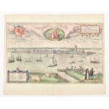
Map of Braun and Hogenberg
Col. copper engr. on one leaf w. Rotterdam and Gouda. Taken from Civitates orbis terrarum. Cologne, ca. 1600. Leaf (37 x 49 cm) w. passe-partout i...
en 1820 et 1821. Traduit de Russe, par M. N******, et revu par M. J.-B. Eyrie's; Ouvrage publiée, avec des corrections et des Notes, par M. J. Kla...
Gotha, Justus Perthes, ca. 1930. Approx. 146 x 188 cm. Map of Australia and Polynesia, relief shown by hachures and spot heights, depths shown by ...
-
2539 item(s)/page