

Lot 7
Table Globe
Table Globe, paper printed and described in German on original ebonized stand around 1900. 40 cm high.
Discover and bid on an impressive mix of collectibles for sale in live and timed online auctions at LOT-TISSIMO.
Table Globe, paper printed and described in German on original ebonized stand around 1900. 40 cm high.
Columbus Globe, paper with colour printed card, on metal base. Berlin around 1960.
various lot with an antique English box with inlay of mother of pearl and a British baton || Lot van een antiek Engels kistje ingelegd met parelmo...
Photolitho,Measures 40 x 30 inches
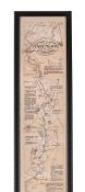
THE OARSMANS AND ANGLERS MAP OF THE THAMES Mounted, framed and glazed 175 x 14cm overall
Nationalsozialismus - Konzentrationslager - - Plan obozu Koncentracyjnego "Gusen" Austrii kolo Lincu. 1:2880. Lichtdruck. Gezeichnet v. M. Kurasni...
Kelvin & Hughes Compass, in metal box. Movable. 20th Century. 8 cm diameter.
Measures approx. 36 x 22 inches, foxing and yelling on edges
Maps of France 1881 "Le Ministre De La Guerre", original case.
Albert Einstein, born on March 14, 1879, in Ulm, in the Kingdom of Württemberg in the German Empire, was one of the most influential scientists o...
Jan VAN CAMPENHOUT (1907-1972) 'City view by Night'Dimensions: (W:60 x H:70 cm)
Asien - Indonesien - - Molluken. "Moluccae Insulae celeberrimae". Mit altem Grenz- und Flächenkolorit, Kupferstichkarte, G. Blaeu in Amsterdam, um...
Australien und Ozeanien - - Sotzmann, Daniel Friedrich. Karte des Grossen Oceans gewöhnlich Das Süd Meer genannt, nebst allen neuen Entdeckungen i...
JOSEF ALBERS (1888-1976) Homage to the square Colored print on paper Publisher: Gemini G.E.L., Los Angeles, California, c.1966 Measures 7.50 X 7....
Deutschland - Berlin - - Britz, N. Plan vom Dorf und Schloss zu Glienicke bei Potsdam. Manuskriptkarte von N. Britz, Berlin, um 1875. Blattgröße: ...
Deutschland - München - - Hollar, Wenzel. Monachium avilica sedes Ducum Bavariae. Gesamtansicht aus der Vogelschau. Kupferstich von WH (Wenzel Hol...
6 bottles of "Château Coufran" dd 1988 in its closed case || 6 flessen "Château Coufran" (Médoc) van 1988 in gesloten kist
Poster titled "Matterhorn Bobsled" 54" x 36" approximate sizeSome wear, backed on linen, some staining/creases, tears, etc.
Himmelsglobus von Carl Rohrbach. Berlin, um 1896, bezeichnet "Himmelsglobus von Dr. Carl Rohrbach, D. Reimer Berlin (Hoefer&Vohsen)", der Globus a...
Seltener Mondglobus von Paul Räth. Leipzig, 1963, bezeichnet mit "Räths Mondglobus, Durchmesser 33 cm, Maßstab 1:10400000, Die Namen der Formation...
Himmelsglobus von Robert Henseling. Berlin, ca. 1920, bezeichnet "Dietrich Reimers Himmelsglobus, bearbeitet von Robert Henseling", der Globus als...
Induktions- oder Schieferglobus. Deutschland, um 1920, ohne Herstellerbezeichnung, der Globus als mit Gips überzogene Pappmaché-Kugel, die Kontine...
Seltenes Lunarium von Ernst Schotte. Berlin, um 1877, der Globus bezeichnet "Die Erdkugel nach den neuesten u. besten Quellen bearbeitet, Berlin E...
Mondglobus Paul Räth. Leipzig, 1976, "Räths Erdmondglobus", das Kartenbild entworfen vom Kartographen Hellmuth Wolf im VEB Räthgloben-Verlag Leipz...
Schöner Himmelsglobus mit figürlichen Sternbildern. Deutschland, um 1915, nicht bezeichnet, der Globus als Pappmaché-Kugel mit 12 farblithographie...
Erdglobus von Wagner & Debes. Leipzig, um 1918, bezeichnet "Erd-Globus, von 96 cm Umfang, neu bearbeitet von Dr. H. Fischer, Leipzig, Wagner & Deb...
Erdglobus mit Atlas-Figur vom Columbus-Verlag. Berlin, um 1925, bezeichnet "Schüler-Globus, Columbus-Verlag G.M.B.H. Berlin-Lichterfelde", der Glo...
Seltener Marine Himmelsglobus aus Kapitänsnachlass. London, 1920, bezeichnet "The Husun Star Globe, H. Hughes & Son LTD, London, 1920", der Globus...
Asien.- Barrow, J. A general chart, on Mercator's Projection, to shew the track of the Lion and Hindostan from England to the Gulph of Pekin in Ch...
Erdglobus nach Georg Christoph Eimmart. Nürnberg, 1705, Faksimile Christian Nebehay, Wien 1958, bezeichnet "L.F., Cum Geographica Orbis, Terrarum ...
Danckwerth.- 6 kolorierte Kupferstichkarten von J. Mejer aus Danckwerth, Newe Landesbeschreibung, Husum, 1652 bzw. Amsterdam, Blaew, 1662. Je ca. ...
Danckwerth.- Konvolut von ca. 100 Kupferstichkarten (mit zahlreichen Dubletten) von J. Mejer aus Danckwerth, Newe Landesbeschreibung, Husum, 1652....
Eckernförde.- Ekelenforda antiquum Holsatiae ad Oceanum peninsulare oppidum. Kolor. Kupferstich von Braun u. Hogenberg, um 1590. 35 x 47 cm. Gerah...
Gottorf.- Sudertheill des Amptes Gottorf. Kolor. Kupferstich von J. Mejer aus Danckwerth, 1652. 40 x 60 cm. Gerahmt.Das Gebiet nördlich der Eider,...
Seltener großer Reliefglobus. Um 1950, nicht bezeichnet, der Globus aus Kunststoff, das Relief überhöht, das physikalische Kartenbild von Hand far...
Geographie-Puzzle. Frankreich, um 1860, Atlas Géographique, drei Karten von Europa, Frankreich und Holland, herausgegeben von A. Logerot, Éditeur,...
Großer Erdglobus von Ludwig Julius Heymann. Leipzig, um 1909, bezeichnet "Erd-Globus, 114 cm Umfang, Durchgesehen von Dr. Henry Lange, Leipzig, Lu...
Erdglobus für den Beamten-Wirtschaftsbund. Berlin, um 1924, bezeichnet "Erdglobus der deutschen Beamten-Buchhandlung, Buchvertrieb des Beamtenschr...
Holstein.- Holsatiae descrip. Altkolor. Kupferstichkarte von Marcus Jordanus bei Ortelius, 1585. 33,5 x 24 cm. Hinter Glas gerahmt.Die schöne Kart...
Konvolut von 25 Kupferstichen meist mit Ansichten, u.a. aus Happel 'Des historischen Kerns'. Um 1680. Je ca. 15 x 20 cm. Jeweils unter Passepartou...
Konvolut von 9 meist altkolor. Kupferstichkarten. Um 1650-1820. Meist je ca. 40 x 50 cm.Enthält: Doctecomius - Portugalliae (Falzdurchriss); Vissc...
Speed.- The Kingdome of Denmarke. Altkolor. Kupferstichkarte von John Speed aus: A Prospect of the most famous parts of the World'. 1626. 39 x 51 ...
Wagrien.- Wagriae Pars Septentrionalis cum praefectura Cismar et Oldenburgh. Kolor. Kupferstichkarte von J. Mejer, gestoch. von Ch. Rothgiesser, b...
eight Panamarenko proof 'inkjet prints' for "Scoth Gambit, from table to steel" || PANAMARENKO (PS VAN VAN HERREWEGHE HENRI ) (1940 - 2019) (PS V...
AFRICA -- "GUINEAE NOVA DESCRIPTIO". (Amst., Mercator/Hondius, c. 1638). Plain engr. map w. 2 cartouches and 2 ships. 342 x 480 mm. -- "AETHIOPIA ...
AFRICA -- "NIGRITARUM REGIO". (Amst.), J. Blaeu, (c. 1670). Handcold. engr. map, w. 2 cartouches. 380 x 570 mm. (Sl. browned, split on fold in upp...
ALLEGORICAL MAP -- (EUROPA REGINA, Queen Europe). (Basel, H. Petri, 1588). Plain allegorical woodcut map from S. Munster's 'Cosmographey', German ...
ALLEGORICAL MAP -- "EUROPA Volgens de nieuwste Verdeeling". Haarlem, F. Bohn, (1794). Cont. handcold. allegorical engr. map. 237 x 167 mm. (Left b...
AMERICA -- "AMERICAE sive Indiae Occidentalis tabula generalis". (Leyden, c. 1630). Plain engr. map of North and South America by J. de Laet/H. Ge...
AMERICA -- "PERUVIAE AURIFERAE Regionis Typus". - On sheet with: "LA FLORIDA". - And: "GUASTECAN Reg." - (Antw., A. Ortelius, C. 1588). Handcold. ...
AMERICA -- "PERUVIAE AURIFERAE Regionis Typus". - On sheet with: "LA FLORIDA". - And: "GUASTECAN Reg." - (Antw., A. Ortelius, C. 1588). Plain engr...
ASIA -- "IMPERII PERCICI delineatio ex scriptis potissimum geographicis Arabum et Persarum". Amst., P. Schenk, 1722. Handcold. engr. map w. decora...
ASIA -- CHINA -- "ASIAE VIII TAB:". (c. 1600). Handcold. engr. map of Central Asia (& Western China). 344 x 405 mm. (A few sm. marg. tears, a bit ...
ASIA -- CHINA -- "KANTON IN PLATTE GRONDT / Plate forme de la Ville de Kanton". (Amst., c. 1665). Plain engr. map from J. Nieuhoff. 286 x 365 mm. ...
ASIA -- INDIA -- "L'INDOSTAN: description de la partie des Indes Orientales qui est sous la domination du grand Mogol". (1660-1679). Plain engr. m...
BELARUS -- MANUSCRIPT MAP of the Belarusian city of Polotsk. (1786). Plan of Polotsk drawn on blueish paper by Ivan Abramovich (?), cold. by hand,...
BELGIUM -- "CORRECTISSIMA DESCRIPTIO Hannoniae Comitatis". Amst., F. de Wit, (c. 1700). Handcold. engr. map w. cartouche. 504 x 585 mm. (A few spl...
BELGIUM -- "LEODIENSIS DIOECESIS". Amst., W. & J. Blaeu, (c. 1643). Handcold. engr. map. 380 x 495 mm. (Split on fold in lower margin). -- "PRIMA ...
CASPIAN SEA -- "GEOGRAPHICA NOVA ex Oriente (…) quarum una Mare Caspium, altera Kamtzadaliam seu Terram Jedso curiose exhibet". Nürnberg, J.B. Hom...
CASPIAN SEA -- "NIEUWE CAART van de Caspische Zee, met alle desselfs riviere, eylanden en dieptens; na de laatste observatien gelegt en verbeeterd...