


A large vintage 1950s (1959) sales promotion wall hanging map of the British Isles. Scale 1:633,600 or 10 miles per inch. Measures approx 150x170c...
Collectables Auctions
Discover and bid on an impressive mix of collectibles for sale in live and timed online auctions at LOT-TISSIMO.
Popular categories
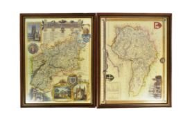
Antique & Vintage Maps
Music Instruments & Memorabilia
Bank Notes
Sports Memorabilia & Equipment
Stamps
Writing Instruments
Cameras & Photography Equipment
Entertainment Memorabilia
Religious Items & Folk Art
Antique Scientific Instruments
Antique Arms, Armour & Militaria
Vintage Wine & Spirits
Taxidermy
Featured auctions
Upcoming auctions


22 item(s)
Filtered by:
- Category,
- Country
- List
- Grid
-
22 item(s)/page
Two 20th Century reproduction maps of South-West interest, featuring a map of 'Somersetshire', dated '1836', and a map of 'Gloucestershire'. Both ...

A collection of seven 20th century Conic Projection maps together with another. The lot to include: the map of Iran (Persia) scale 1:4,000,000 pla...

Saxton, Christopher (c.1540-c.1610) & William Hole (d. 1624) - A 17th century etched & hand coloured map of Oxfordshire. The map reading: Oxoniens...

David Michael Jones (1895-1974) Map of the Third Voyage wood engraving 19 x 16cm.

Lot 465
David Roberts Print
19th century A.D. Printed map of Egypt and Nubia with locations marked of the sketches of David Roberts, RA on his 1849 expedition; mounted in a g...

Vintage Breweriana interest Whitbread & Co Ltd metal pub map of Kent, 83cm x 57cm

Quantity of Roleplaying maps & figures. Consisiting of paper & card maps to include Dungeons & Dragons, metal & plastic figures. Unchecked for com...

1st-4th century A.D. Mainly domestic ware fragments, mortaria, amphorae and other types; in a wooden collector's tray, some with inked inscription...

1st-4th century A.D. Including mainly rim fragments, one with the pouring lip; on marked 'Colchester / CM/23', another with 'Col / CM/19'. 1.64 k...

Lot 685
Nine Edwardian coloured folding maps of Sussex farms including Pebsham Farm, Court Lodge Farm, Upper
Nine Edwardian coloured folding maps of Sussex farms including Pebsham Farm, Court Lodge Farm, Upper Wiltshire Farm and Catsfield Place Farm, each...

Adolf Stielers hand atlas with coloured maps

1st-4th century A.D. Irregular kiln slag fragments with various inclusions. 1.33 kg total, 4.6-12.4 cm (1 3/4 - 4 7/8 in.). Found Colchester, Ess...

1st century A.D. Including burnished rim and base fragments, all but two with inked or pencilled reference notations including 'Col' for Colcheste...

Mousterian Period, 200,000-30,000 B.C. Biconvex in section with narrow point. Cf. MacGregor, A. (ed.), Antiquities from Europe and the Near East i...

Lower Palaeolithic Period, 480,000-250,000 B.C. Ovate in form with thick butt, lentoid in section, patinated white. Cf. MacGregor, A. (ed.), Antiq...

Mousterian Period, 200,000-30,000 B.C. Ovate in plan with thin, lentoid section. 96 grams, 85 mm (3 3/8 in.). Found Plazac, France. From an old F...

Cased Military interest survey Radaic no 2 meter, 19cm H x 28cm W x 11cm D

Circa 1840 A.D. Antique woodcut map of lower Japanese islands (Kyushu, Shikoku, Honshu) with very extensive detail depicting towns, villages, temp...

19th century A.D. Penannular round-section bracelet with clubbed ends. 73.2 grams, 58 mm (1 1/4 in.). From the shipwrecked English Schooner 'Duor...

19th century A.D. Group of two penannular round-section bracelets with clubbed ends. 150 grams total, 59-63 mm (2 3/8 - 2 1/2 in.). From the ship...

19th century A.D. Group of two penannular round-section bracelets with clubbed ends. 155 grams total, 57 mm each (2 1/4 in.). From the shipwrecke...