Verfeinern Sie Ihre Suche
Auktionshaus-Kategorie
Kategorie
Sortieren nach:
- Nur Massenlose anzeigen,
- Auktionshaus-Kategorie
- Liste
- Galerie
-
11 Los(e)/Seite
Ein Abonnement der Preisliste ist notwendig um Ergebnisse, von Auktionen die vor einem längeren Zeitraum als 10 Tagen stattgefunden haben, ansehen zu können. Klicken Sie hier für mehr Informationen

Signed Napoleonic Map
Signed Napoleonic Map, being a important original nicely presented Plan of Pizzighettone & Gerra (Lombardy) believed produced as part of Napoleon'...
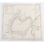
Signed Napoleonic Map
Signed Napoleonic Map, important original Plan of Lodi showing the defences in watercolour 17" x 16" to support Napoleon's conquest of Italy 1796,...
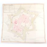
Signed Napoleonic Map
Signed Napoleonic Map, excellent hand drawn coloured map of Sabionita (Lombardy) 26" x 23" produced as part of Napoleon's conquest of Italy 1796 a...
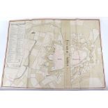
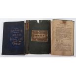
Original Map London in Miniature with the Surrounding Villages, Published 1808 by Edward Mogg
Original Map London in Miniature with the Surrounding Villages, Published 1808 by Edward Mogg. C.95cms x 52.5. Slight wear to a couple of folds an...
Environs of Sevastopol with the Batteries and Approaches by James Wyld November 1854 c.48cms x 65 cms folds into cloth boards
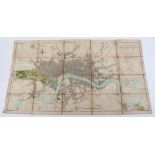
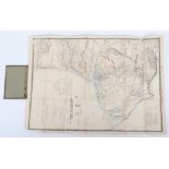
Original Map Plan of London and Westminster and the Borough of Southwark by Wyld 1838, c.100 cms x c.70 cms folding, together with "Tape Indicato...
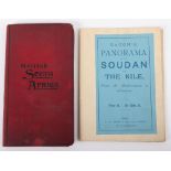
Maps, Panorama of the Sudan and the Nile From the Mediterranean to Khartoum (in colour c.1900) by Ba
Maps, Panorama of the Sudan and the Nile From the Mediterranean to Khartoum (in colour c.1900) by Bacon, together with British South Africa (foldi...
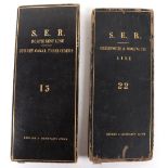
Railway Historic Maps
Railway Historic Maps, two extensive folding S.E.R. (South East Region) maps in leather covers, one covering the line Greenwich & Woolwich c.1 in...
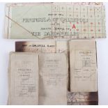
Important Collection of Original Gallipoli Maps, includes Gallipoli Sheet 1, 1:40,000 showing the Straits, the Forts, and Cape Helles together wit...
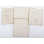
WWI Maps of Mesopotamia
WWI Maps of Mesopotamia, 4 original maps, including Samarrah, (T.C. 97) scale 1 inch to 1 mile, dated 14-10-17 and stamped Army Signals, c.45 cm...
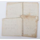
WWI Trench Linen Maps of Mesopotamia, Fat-hah, (GHQ) 3 inch to 1 mile with a large number of numbered Trenches shown both sides of the Tigris just...
-
11 Los(e)/Seite