Verfeinern Sie Ihre Suche
Auktionshaus-Kategorie
Kategorie
Sortieren nach:
- Auktionshaus-Kategorie,
- Kategorie
- Liste
- Galerie
-
7 Los(e)/Seite
Ein Abonnement der Preisliste ist notwendig um Ergebnisse, von Auktionen die vor einem längeren Zeitraum als 10 Tagen stattgefunden haben, ansehen zu können. Klicken Sie hier für mehr Informationen
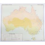

Atlas of Australia
Atlas of Australia, large scale detailed maps showing Mineral resources, Climatic Regions etc 18 sheets,
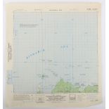
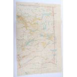
Series of Original Provisional Maps of the Admiralty Islands in the Bismarck Sea, the scene of an American invasion in 1944 against the Japanese. ...
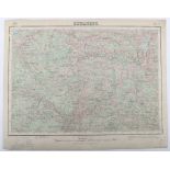
Maps Spain 1:50,000 1929 onwards
Maps Spain 1:50,000 1929 onwards Includes Betanzos and Pedrola c.45 sheets,
Maps,GSGS4567 Sweden 1:300K WW2 Period, 7 sheets, generally good condition
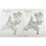
Maps, Rijksdienst Voor Het National Plan (Holland), c 1947, 27 sheets see images,
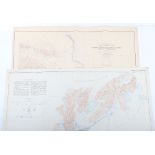
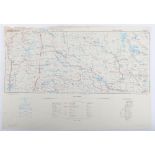
Two Canadian Maps
Two Canadian Maps, one Reconnaissance map of Yukon Tanna Region Alaska Circle Triangle Edition of May 1910 1:250,000 (Alaska sheet 641) & two Cont...
East Lillooet Sheet, Department of Lands, British Columbia, Jan 4th 1926 Large coloured map, scale 2miles to 1 inch. c.40 X c.75cms. Interesting m...
-
7 Los(e)/Seite